
Luni River
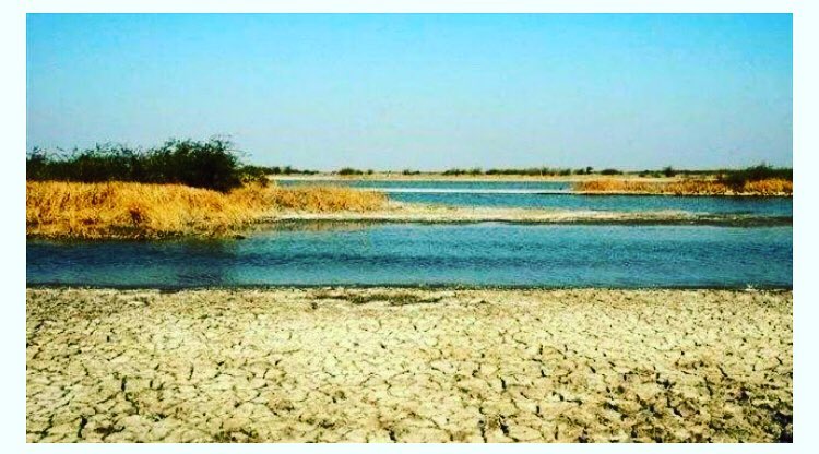
Fig : Luni River – Saline Water
Source
- It Originates in the Naga hills of Aravalli Ranges near Pushkar valley in Ajmer District .
- It is also known as Sagarmati .
- After crossing Govindgarh,it joins Sarsuti river which originates from pushkar lake and from then on it is referred to as Luni River .
Naming of Luni River .
- The name is derived from Sanskrit word Lavanavari which in English “Salt River “.
- The Luni river is not salty until it reacht Balotra ,where high salt content in the soil impacts the river.
Mouth of the river
The river discharges its water in Rann Kachchh in the state of Gujarat.
Tributaries
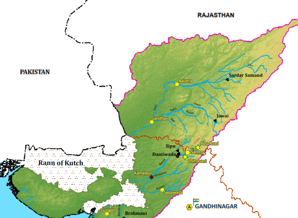
Fig : Luni River map – Source :WRIS
Right Tributaries
Jojri
Left Tributaries
- Lilri
- guhiya
- Bandi
- Sikri
- Jawai
- Khari
- Bandi
- Sikri Bandi
- Sagi
Tributaries Explanation :
1.Jawai River :
- It originates in Aravalli Ranges in the state of Rajasthan ..
- Jawai dam is built on this river
2.Bandi River
- The rivers Khari and Mithai confluence gives rise to Bandi river.
- It joins Luni at Lakhar Village.
- Hemawas Dam is built on this river.
3.Sikri River
- It originates from the western slopes of Aravalli Ranges in pali district.
- Bankli Dam is located on this river.
4.Guhiya River
It is a small river that runs only on monsoon season .
Dams in Luni river :
- Dantiwada Dam
- Sipu Dam.
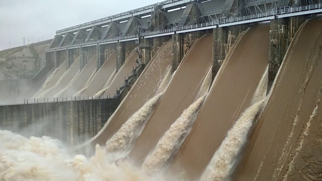
Fig : Dantiwada Dam
Luni Basin :
The Luni Basin is bounded by
1.Aravalli Ranges and Gujarat plains on the east
2. thar desert on north
3.Arabian sea on the south and west.