
Tapti river
- The basin lies over states of Madhya Pradesh, Maharashtra and Gujarat.
- Total area of the river basin is 65,145 Sq.km
The river basin is bounded by
1.the Satpura range on the north,
2.the Mahadev hills on the east,
3.the Ajanta Range and the Satmala hills on the south
4. the Arabian Sea on the west.
The Tapi is the second largest westward draining river of the Peninsula.
Source of the river :
It originates near Multai reserve forest in Betul district of Madhya Pradesh
The important tributaries of tapti river are the Suki, the Gomai, the Arunavati and the Aner which joins it from right, and those joining from left are the Vaghur, the Amravati, the Buray, the Panjhra, the Bori, the Girna, the Purna, the Mona and the Sipna.
River topography
- There are two well defined physical regions, in the basin, viz hilly region and plains; the hilly regions comprising Satpura, Satmalas, Mahadeo, Ajanta and Gawilgarh hills are well forested.
- The plain covers the Khandesh areas which are broad and fertile suitable for cultivation primarily.
Soil of the River Basin
The basin consists of black soils; The coastal plains of Gujarat are composed of alluvial clays with a layer of black soil above.
The soil in the Tapi basin up to Ukai Dam can be broadly classified in to three groups.
- Coarse shallow soils
- Medium black soils
- Deep black soils.
Tributaries
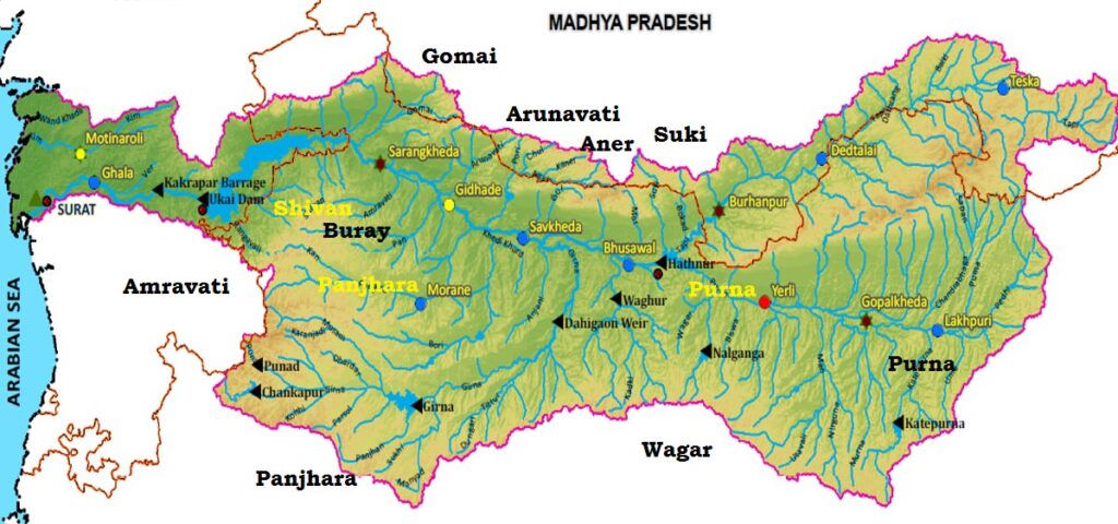
Fig : Tapti River Map Source : WRIS
Right Tributaries
On the right bank 4 tributaries namely.
- Vaki River
- The Gomai River
- The Arunavati River
- The Aner
Left Bank tributaries
On the left bank, 10 important tributaries namely
- Nesu River
- Arunavati River
- Buray River
- Panjhra River
- Bori River
- Girna River
- Vaghur River
- Purna River
- Mona River
- Sipna River
Tributaries Explanation
Purna River
- It lies in the state of Maharashtra and Madhya Pradesh .
- It is the only river in the upper Tapi Basin, which has a perennial flow.
- It Rises in the Gawilgarh hills .
- Purna flows first in a South westerly direction for about 60 km through hills and forests before it enters the Purna plains.
- Then Purna joins the Tapi north west of Edalabad.
Girna River
- The Girna River is a river in Maharashtra state of southern India.
- It originates at Kem peak in the Western Ghats range of Nashik District.
- The dams on the river are Chanakapur and Girana Dam.
- The basin of the Girna lies on the Deccan Plateau, and its valley has fertile soils which are intensively farmed.
Gomai
- It originates in Satpura Mountain Range and merge in Tapi River around 2 km east of Prakasha.
- Gomai river itself has many small tributary rivers like Susri river (passing by Sultanpur), Tipria river (passing by Mandane), Umri river, Sukhi river.
Panzara
- The Panzara-Kan or Panjhra is a river in Khandesh region of Maharashtra state of India.
- One small reservoir named Latipada dam is constructed just after its origin.
Pedhi
- The only important left bank tributary of the Purna is the Pedhi.
- It rises in the low hills near Rithpur and receives a number of small affluent both from the east and the west, the chief on the west being the Naghira river.
Arna
The river emerges from the Satpuda hills in Betul district and flows in a south and south-easterly direction passing by Sirasgaon to join the Purna just below Deurwada.
Projects in Tapti River
- Hathnur Dam (Maharashtra)
- Kakrapar Weir (Gujarat)
- Ukai Dam (Gujarat)
- Girna Dam (Maharashtra)
- Dahigam Weir (Maharashtra)
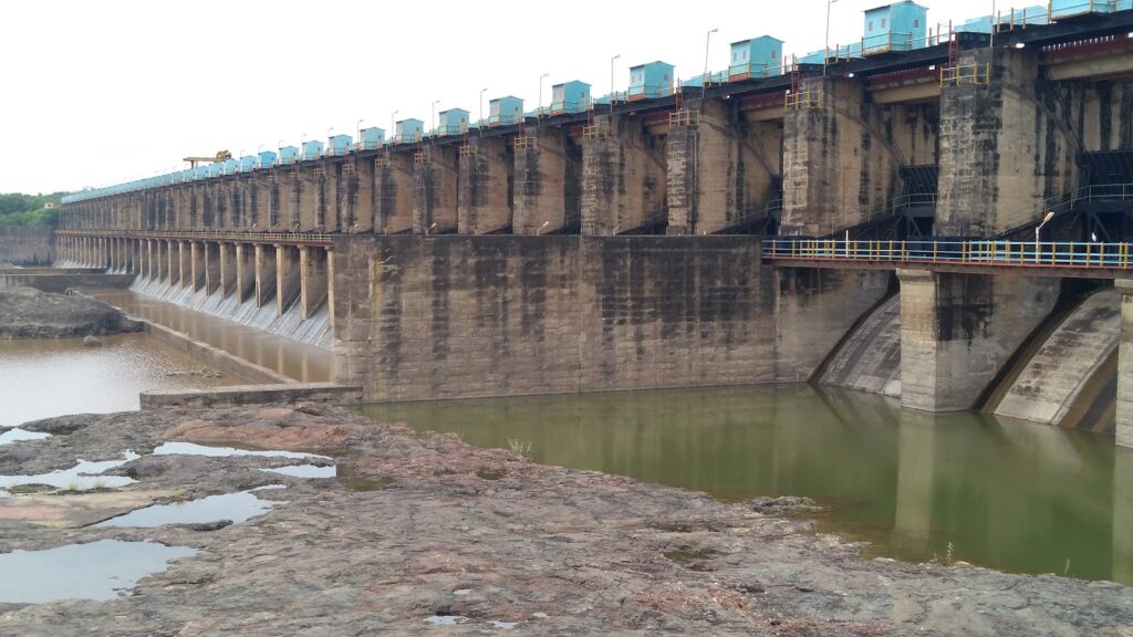
Fig : Hathnur Dam